Highway 93N runs 232 km (144 miles) between Lake Louise and Jasper, climbing over the Continental Divide at Bow Summit and skirting the Columbia Icefield at Sunwapta Pass along the way. It isn't a park attraction with a gate and a ticket line. It's a public highway through Banff and Jasper National Parks, and you stop wherever the mountains tell you to.
This guide walks the route south to north: the stops that matter, the Columbia Icefield's different ways to see the ice, the hikes worth the detour, and the logistics — park pass, gas, cell service — that a remote mountain highway makes non-negotiable. For the fuller backstory on the icefield itself, see our Columbia Icefield overview.
Icefields Parkway at a Glance
The Icefields Parkway (Highway 93N) covers 232 km (144 miles) between the village of Lake Louise and the townsite of Jasper, threading through both Banff and Jasper National Parks. Driven straight through with no stops, it takes about three to five hours. Almost nobody does that — six to nine hours covers a proper day with the main viewpoints, and one to three days leaves room for hikes and an overnight.
The road tops out at Bow Summit, 2,088 m above sea level, just before the turnoff to Peyto Lake, then drops and climbs again toward Sunwapta Pass and the Columbia Icefield. It's paved and two-lane the whole way, with no traffic lights and long stretches where you won't see another car for minutes. Most trips start from Lake Louise or Banff; see getting to the parkway for route options from both.
After the 2024 Jasper wildfire, some travelers assume the drive is compromised. It isn't. The highway and its major landmarks — the Columbia Icefield, Athabasca Falls, Sunwapta Falls — sit outside the burn area and are fully open, though a handful of secondary trails and campgrounds closer to Jasper are still being restored.
- Distance: 232 km (144 mi), Lake Louise to Jasper
- Drive time: 3-5 hours non-stop; 6-9 hours with stops
- Highest point: Bow Summit, 2,088 m
- Park pass: required, from $12.25 per adult per day
- Gas: one station, Saskatchewan River Crossing, seasonal
- Cell service: none for the full 232 km
Best Stops Along the Parkway (South to North)
More than twenty named pull-offs dot the route, but a dozen actually justify the brake pedal. Here they are grouped by what they are, in driving order, rather than buried in a mile-by-mile list.
Lakes
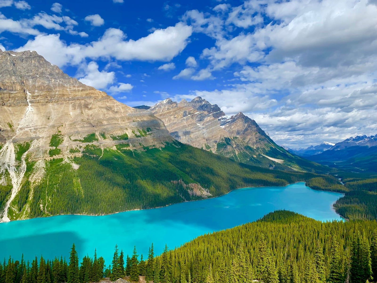
Herbert Lake is the first stop worth taking, just minutes past Lake Louise — a small, reed-fringed lake that mirrors Mount Temple on a still morning, and most people drive right past it. Bow Lake, about an hour north, sits at the foot of Crowfoot Glacier beside the century-old Num-Ti-Jah Lodge; the lakeside walk is flat and takes twenty minutes. Peyto Lake, reached via the Bow Summit lookout, is the one every brochure uses: glacial silt turns the water a vivid turquoise, best seen from the upper viewpoint about fifteen minutes on foot from the parking lot. Waterfowl Lakes, a little further north, are quieter and popular with campers rather than day-trippers.
Waterfalls & Canyons
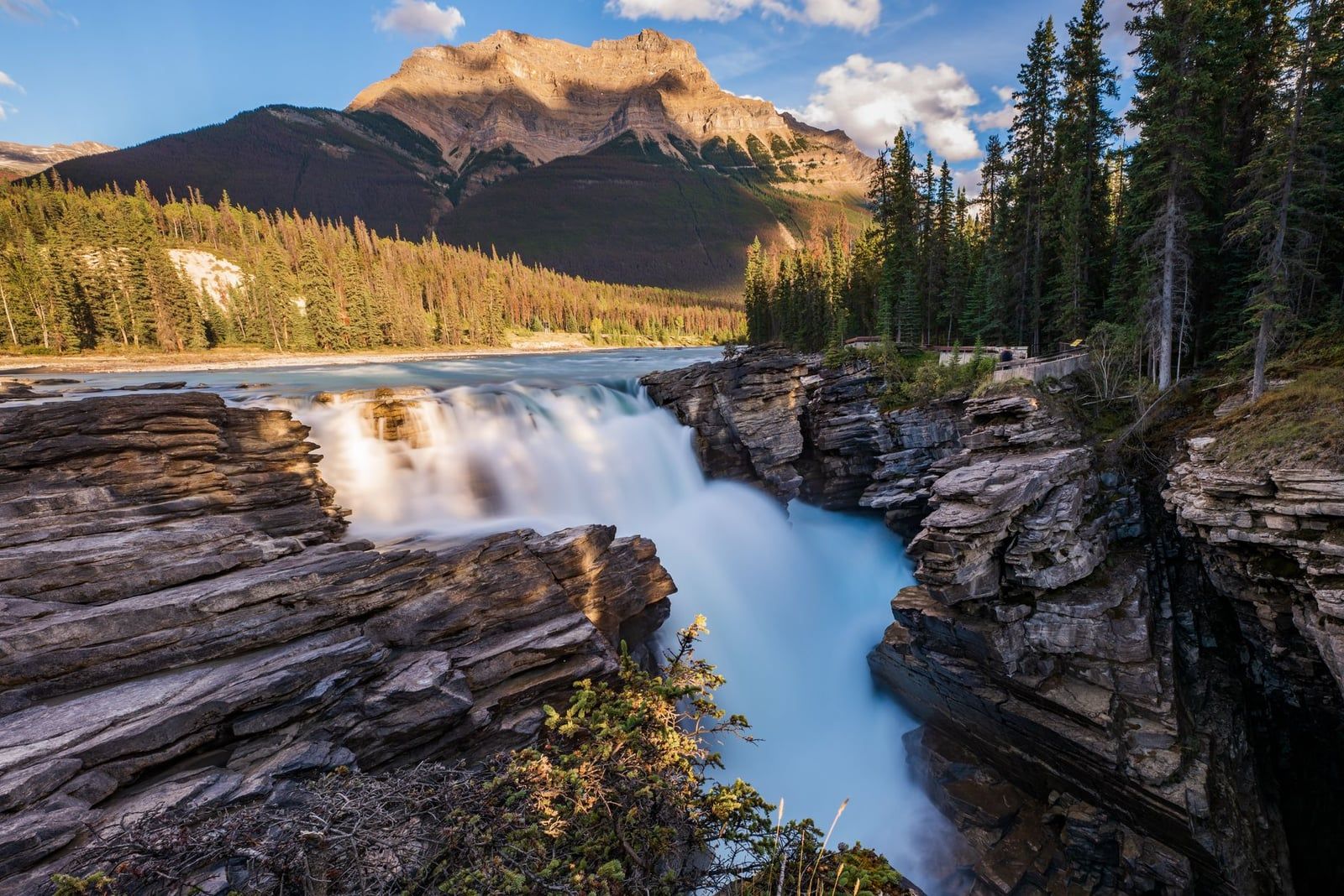
Mistaya Canyon is a short, flat walk to a limestone gorge where the river has carved smooth potholes into the rock — worth twenty minutes even with kids in tow. Further north, the Weeping Wall is a cliff streaked with seasonal waterfalls, dramatic during June runoff and frozen into ice columns favored by ice climbers in winter. Sunwapta Falls, fed by the Athabasca Glacier, drops in two tiers a short walk from its own parking lot, about 178 km from Lake Louise and 55 km from Jasper. Tangle Falls, a roadside cascade just south of the icefield, needs no walk at all. Athabasca Falls is the most powerful of the group: the full Athabasca River squeezes through a narrow limestone gorge with enough force to have carved a channel now sitting dry beside it, and paved platforms get you close enough to feel the spray.
Viewpoints
Crowfoot Glacier hangs above Bow Lake and is visible right from the road, no walk required. Saskatchewan River Crossing, roughly 80 km from Lake Louise, marks the junction with Highway 11 and the meeting point of the North Saskatchewan, Howse and Mistaya Rivers — it's also the only place to buy gas on the entire parkway. Parker Ridge and Wilcox Pass, covered below, add the route's best icefield views for anyone willing to walk for an hour or two.
| Stop | From Lake Louise | From Jasper |
|---|---|---|
| Crowfoot Glacier Viewpoint | 36 km | 197 km |
| Saskatchewan River Crossing | 80 km | 152 km |
| Columbia Icefield Discovery Centre | 125 km | 108 km |
| Sunwapta Falls | 178 km | 55 km |
| Athabasca Falls | 202 km | 31 km |
The Columbia Icefield & Glacier Skywalk
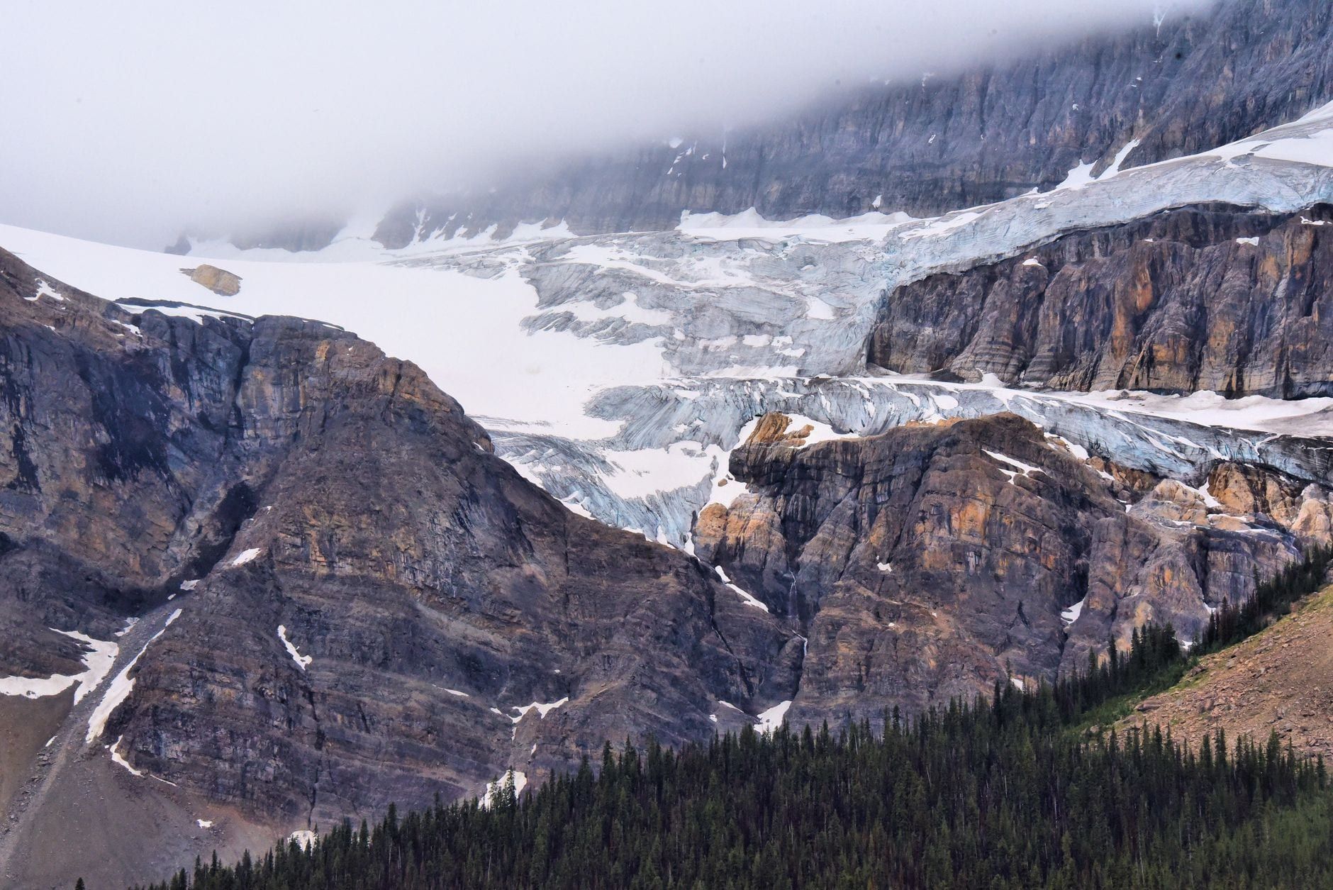
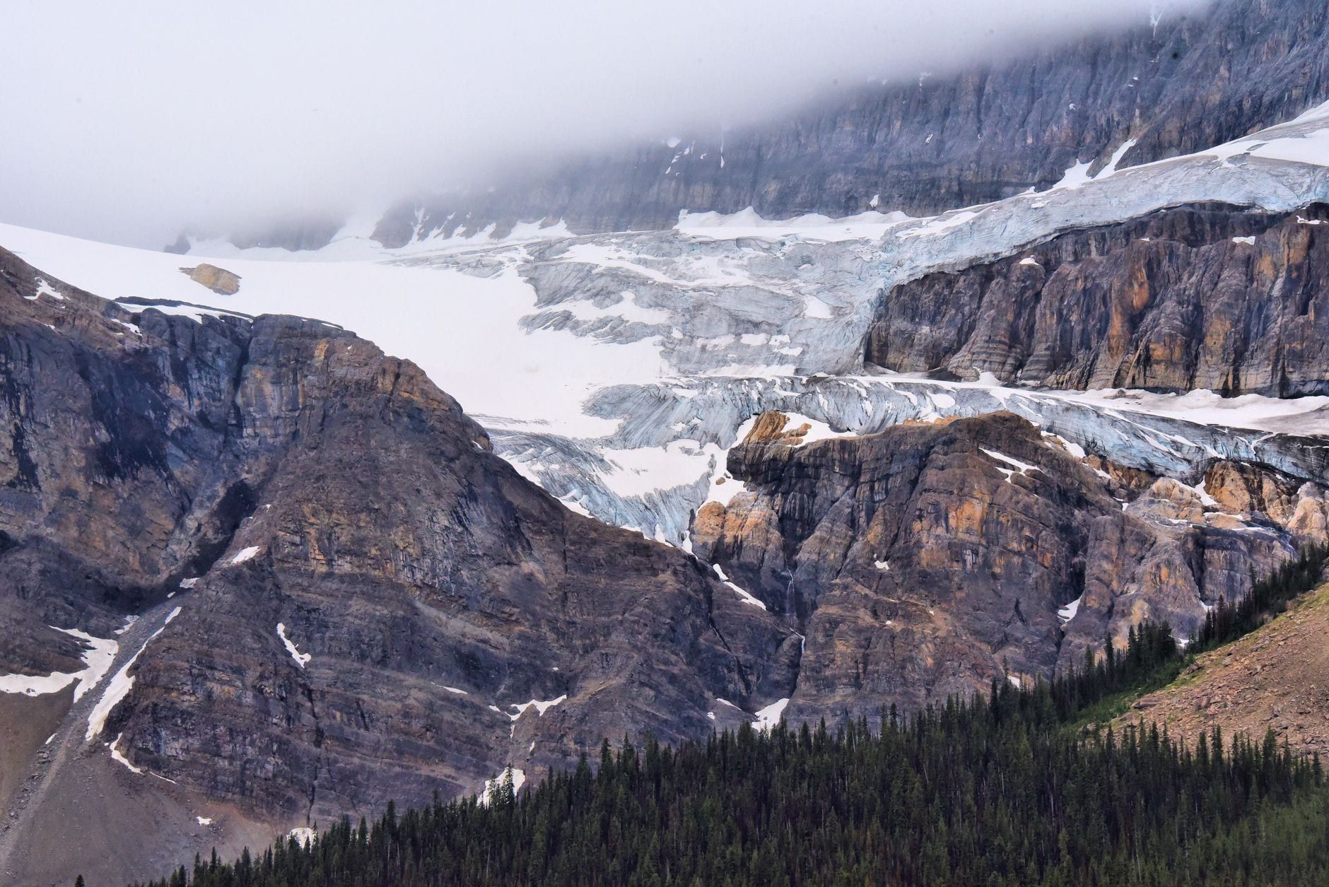
The Columbia Icefield is the largest ice field in the Rocky Mountains, a 325-sq-km cap of ice up to 365 m thick straddling the Continental Divide on the Alberta-BC border. It feeds eight major outlet glaciers, including the Athabasca Glacier that spills almost to the roadside, and its meltwater eventually reaches the Pacific, Atlantic and Arctic Oceans — the only place in North America where a single ice mass drains to three oceans. Mount Columbia, at 3,747 m, is Alberta's highest peak and rises from the same ice cap.
The Columbia Icefield Glacier Discovery Centre sits at Sunwapta Pass, 2,035 m up, and is the hub for parking, washrooms, food and tour tickets. It also holds a sobering statistic: the Athabasca Glacier has retreated more than 1.5 km and lost over half its volume since the late 1800s, and it's currently losing about five metres of depth a year. What you're looking at is visibly shrinking within a single lifetime.
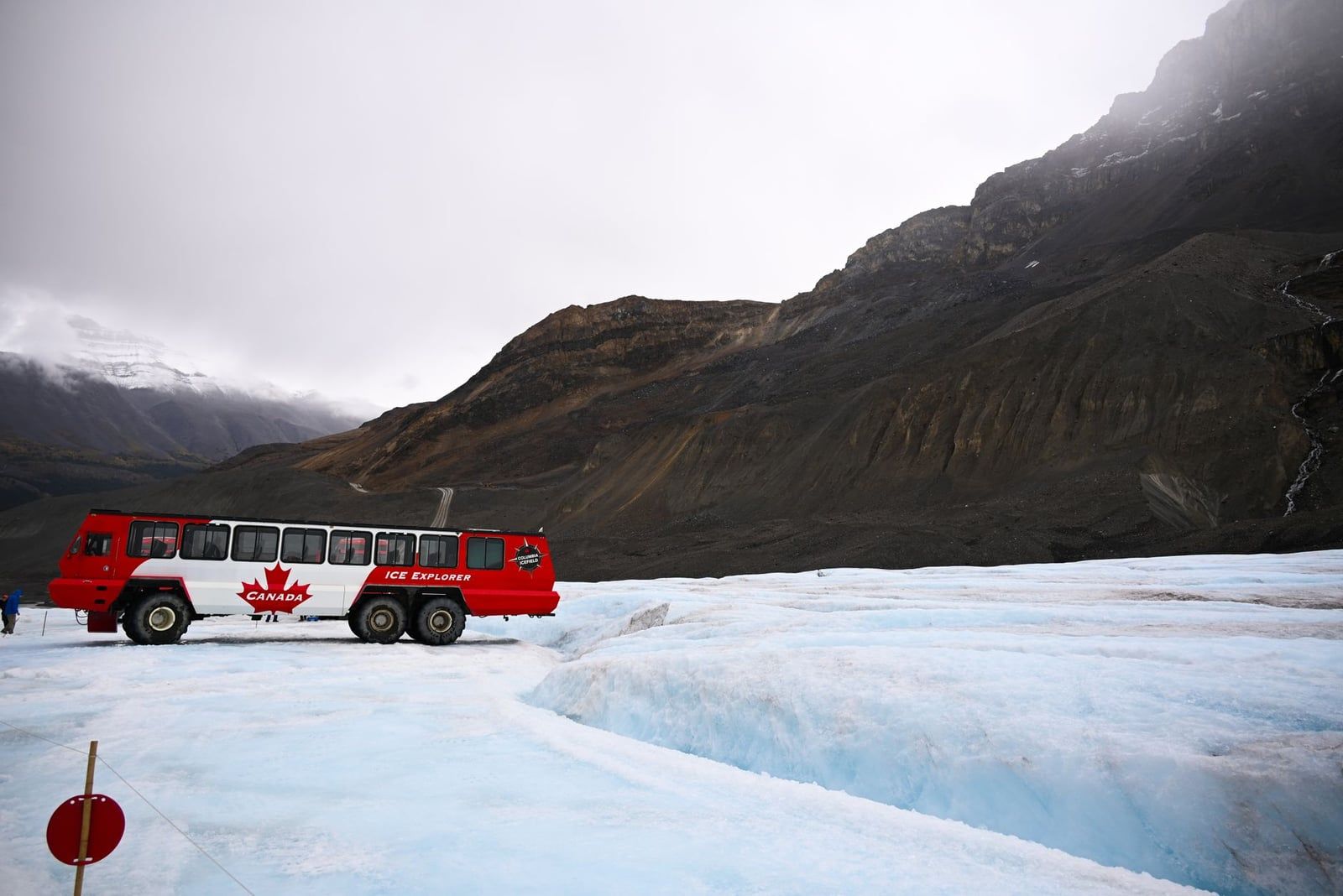
The Ice Explorer buses are purpose-built, all-terrain vehicles — only 23 exist in the world — that grind down a steep moraine slope onto the surface of the 10,000-year-old glacier, giving you 15 to 25 minutes to walk the ice and fill a bottle with meltwater.
| Way to see it | Cost | Time needed |
|---|---|---|
| Free viewpoint (Wilcox Pass, Parker Ridge, Stutfield lookout) | Free with park pass | 30 min-2 hrs |
| Glacier Skywalk only | From about CA$41 adult / CA$26.65 child, advance | 30-45 min |
| Columbia Icefield Adventure (Ice Explorer + Skywalk) | From about CA$109 adult / CA$70.85 child, advance | 2.5-3 hrs |
| Guided IceWalk (small-group, further onto the ice) | Priced separately through the outfitter | Half day |
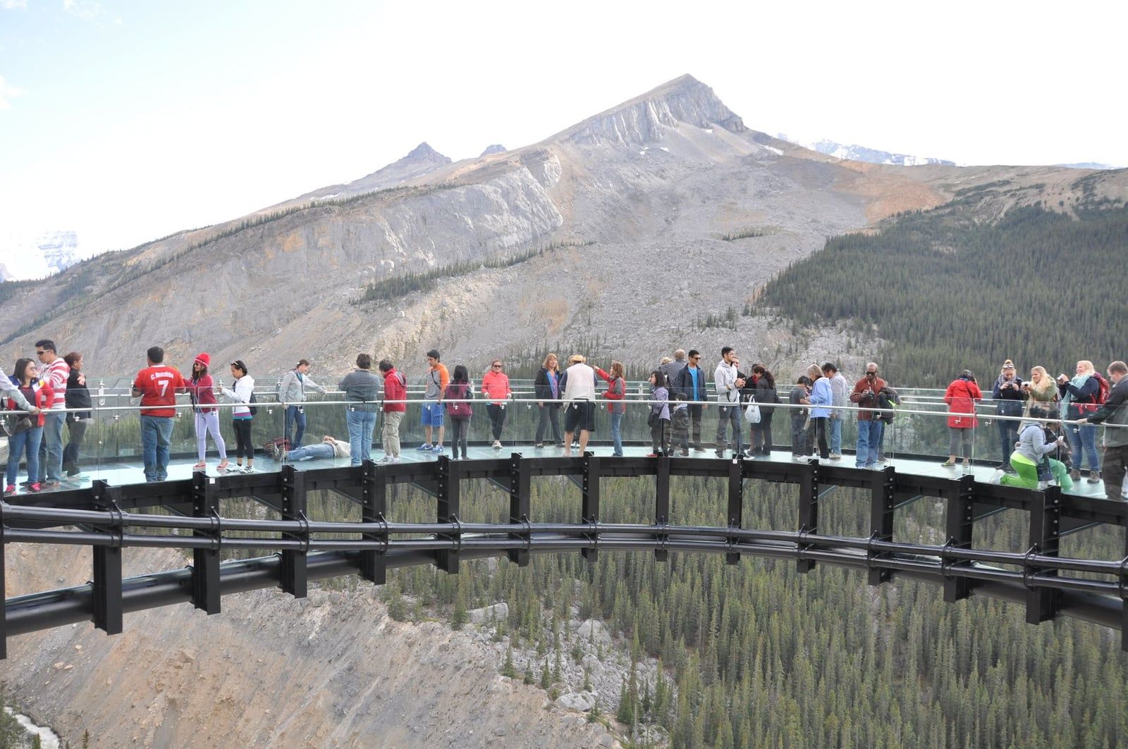
First-timers with half a day should skip the paid tours and drive to Wilcox Pass or Parker Ridge instead — the view is just as good and free once you've covered the park pass. If you want the novelty of standing on ancient ice, book the Columbia Icefield Adventure online at least two weeks ahead, since summer walk-up tickets sell out and tours after 3:30 p.m. get a 20 percent discount. Families who just want the view without the crowds should do a Skywalk-only visit — the 800 m glass-and-steel loop hangs 280 m above the valley and takes under an hour. Anyone chasing real ice underfoot beyond the fenced tourist zone, with crampons and a mountaineering guide, should book a specialist outfitter like IceWalks rather than the standard bus tour. One quirk worth knowing: the Stutfield Glacier viewpoint pullout is only accessible driving southbound, from Jasper toward Lake Louise.
Top Hikes Along the Way
Three trails are worth planning a stop around. Everything else is a bonus if you've got the time.
Parker Ridge
Parker Ridge gives the best return on effort on the whole parkway: a round trip of roughly 5-6 km delivers a full view of the Saskatchewan Glacier in under two hours, switchbacking above the treeline the entire way. It's rated easy to moderate and gets busy by mid-morning in July and August — start early.
Wilcox Pass
Wilcox Pass is steeper, with a bigger payoff: about 8 km round trip (up to 11.2 km if you continue past the pass), climbing roughly 335 m to open meadows facing Mount Athabasca and the icefield across the valley. It's rated moderate and takes three to four hours at a comfortable pace — the same view campers get for free at the Wilcox campground below.
Mistaya Canyon
Mistaya Canyon needs almost no commitment: a 1 km return walk on an old road bed, gaining about 35 m, ending at a footbridge over a limestone slot the river has carved into curves and potholes. It's an easy add-on for anyone, kids included.
Further stops reward more ambitious hikers. Bow Glacier Falls and Iceberg Lake, both reached from the Bow Lake trailhead, add a half-day out-and-back through subalpine forest to a waterfall and a glacier-fed lake. Sunset Lookout is steeper and far less crowded than the marquee trails, better suited to hikers who'd rather earn their view alone. Near the Jasper end, Valley of Five Lakes strings together five color-graded lakes on a gentle loop, a good stretch-your-legs stop after hours in the car. Whichever you pick, carry bear spray and check trail conditions at a visitor centre before setting out — trails close for wildlife activity without much warning.
Practical Tips: Passes, Gas, Cell Service & Safety
A Parks Canada day pass is mandatory to drive the parkway, since it runs through both Banff and Jasper National Parks: $12.25 per adult per day, $10.75 for seniors, free for anyone 17 and under, and $24.50 for a family or group of up to seven. Buy it online or at a park gate before you lose signal — see opening hours and entry fees for current rates. There's no way to pay partway along the route.
Fuel is the other non-negotiable. Saskatchewan River Crossing, about 80 km north of Lake Louise, is the only gas station on the parkway, and it's open seasonally, roughly April through October. There's no fuel at the Columbia Icefield Centre. Fill up completely in Lake Louise or Jasper before you leave — running low here means a long walk, not a short one.
Cell service doesn't exist along the 232 km — not one bar, from the moment you leave Lake Louise until Jasper comes into view. Download offline maps, your park pass, and any hotel or tour confirmations before you go. Parks Canada recommends checking 511 Alberta and weather.gc.ca the morning you leave, since that's your last chance at real-time road information.
Winter tires or chains are legally required on the parkway from November 1 to April 1, storm or no storm. The speed limit runs about 90 km/h, though wildlife jams — a line of cars stopped for a bear or a herd of bighorn sheep — will slow that without warning. Give wildlife 30 m of space generally and 100 m from bears, and never stop in the road to photograph an animal; pull fully onto a shoulder or skip the shot.
Washrooms show up roughly every fifteen to twenty minutes at the main pull-offs and campgrounds, so there's rarely a long stretch without one. If the highway closes in winter, the detour — Highway 1, then Highway 22, then Highway 16 — turns a three-hour drive into seven or eight.
Where to Eat, Stay & Camp
Food along the parkway is close to nonexistent, so stock up before leaving Lake Louise or Jasper. The three real options between them are the food court at the Columbia Icefield Discovery Centre, a small café and store at Saskatchewan River Crossing, and the dining room at Sunwapta Falls Rocky Mountain Lodge. Pack snacks and water regardless.
Lodging clusters at both ends and at two points in between. Lake Louise village has the widest range of hotels; Jasper the same at the north end. In the middle, The Crossing Resort at Saskatchewan River Crossing and Glacier View Lodge at the Icefield Centre are the only two places to sleep directly on the route, and both book out early in summer. Sunwapta Falls Rocky Mountain Lodge splits the difference for anyone breaking up the Jasper-side leg.
Frontcountry campgrounds string the length of the parkway — Mosquito Creek at 27 km from Lake Louise, Waterfowl Lakes at 60 km, Rampart Creek at 91 km, Wilcox at 127 km, Jonas at 156 km, and Honeymoon Lake at 183 km — nearly all summer-only and several first-come, first-served. For something different, wilderness hostels at Mosquito Creek, Rampart Creek and Hilda Creek trade a tent for a bunk and a woodstove at a fraction of a hotel's cost.
Best Time to Go & Winter Driving
Mid-June through early September is peak season: long daylight, wildflowers on the alpine meadows, and RVs stacking up at every pull-off. It's also when the Columbia Icefield Adventure and Skywalk run full hours and campgrounds fill by early afternoon.
Early June and September trade a little crowding for a little uncertainty — lakes can still carry ice at the edges in early June, and fall color along the river flats peaks in mid-to-late September. Both months are quieter than peak and still run full services.
The parkway stays open year-round, but nearly everything on it doesn't: gas, restaurants, most lodging, and all but a couple of campgrounds close for the season roughly from November to April. Storm closures do happen, usually for a day or two rather than the whole season, and winter tires or chains are mandatory throughout. Backcountry skiers use the season differently — the Athabasca Glacier becomes a ski-touring objective in its own right, though it demands real glacier-travel skills; see our guide to Athabasca Glacier ski touring before considering it. Drive the parkway in winter for frozen waterfalls and empty pull-offs, not for convenience.
How Much Time to Budget: Itinerary Ideas
The stop list and hikes above turn into four real plans, depending on how many hours or days you've got. Pick the one that matches your trip instead of guessing at a vague day-or-two range.
Half day (3-5 hours)
Driving straight to the Columbia Icefield and back covers the essentials — Herbert Lake, Bow Lake, Peyto Lake, and the icefield viewpoint — with just enough time for photos and no hikes. Fine if you're short on time, but you'll feel rushed past Athabasca Falls.
Full day (6-9 hours)
Add Mistaya Canyon, a stop at Saskatchewan River Crossing, the Athabasca Falls boardwalks, and one short hike — Parker Ridge fits the time best — and you've got a real day trip between Lake Louise and Jasper. This is the sweet spot for most self-drivers with only one day to spare.
Two days
Break the drive with a night at Glacier View Lodge or in Jasper, and the extra time buys Wilcox Pass and a full Columbia Icefield Adventure or Skywalk without rushing either. Mornings tend to be calmer at the lakes, so aim to drive that stretch early.
Three days
A third day makes room for Bow Glacier Falls or Iceberg Lake from Bow Lake, the quieter Sunset Lookout, and enough slack to wait out a weather delay at the icefield — which happens more often than people expect at 2,035 m.
Self-driving beats a guided bus for one reason: you stop where you want, for as long as you want, instead of following a fixed route that only hits a handful of pull-offs. A guided day tour from Banff or Calgary makes sense if you'd rather not drive mountain roads yourself, or want the Columbia Icefield ticket already built in — compare tours from Banff or tours from Calgary against the cost of a rental car plus admission.
Frequently asked questions
How long does it take to drive the Icefields Parkway?
About three to five hours non-stop; six to nine hours is realistic with stops for a single day; give it one to three days if you're adding hikes and an overnight.
Do you need a park pass for the Icefields Parkway?
Yes. A Parks Canada day pass costs $12.25 per adult, $10.75 for seniors, and is free for anyone 17 and under; a family or group of up to seven pays $24.50 a day. Buy it online before you go, since there's no signal to do it along the way.
Is there gas along the Icefields Parkway?
Only one station, at Saskatchewan River Crossing about 80 km north of Lake Louise, and it operates seasonally, roughly April through October. Fill up in Lake Louise or Jasper before you set out.
Is there cell service on the Icefields Parkway?
None. The entire 232 km has no coverage, so download offline maps, your park pass, and any bookings before you start driving.
Can you drive the Icefields Parkway in winter?
Yes, it's open year-round, but winter tires or chains are legally required from November 1 to April 1, most services close for the season, and storms can shut sections for a day or two. Check 511 Alberta before you leave.
What is the highest point on the Icefields Parkway?
Bow Summit, near the Peyto Lake viewpoint, at 2,088 m above sea level.
Is the Icefields Parkway open after the 2024 Jasper wildfire?
Yes. The highway and its major landmarks — the Columbia Icefield, Athabasca Falls, Sunwapta Falls — sit outside the burn area and are fully open. A few secondary trails and campgrounds closer to Jasper are still being restored.
Which direction is better to drive, Lake Louise to Jasper or Jasper to Lake Louise?
Either works, and most stops are signed both ways. One exception: the Stutfield Glacier viewpoint pullout is only accessible driving southbound, from Jasper toward Lake Louise.